Pedalglobe

Bike routes & best time to go

When is it pleasant where? Pedalglobe plans bike trips around the climate, routes worldwide on your device and shows the countries en route. No account, no subscription.

Coming soon to the App Store See the features

For iPhone and iPad with iOS and iPadOS 26.1 or later · Free download, Pedalglobe Pro as a one-time purchase · English and German

Pedalglobe on iPhone: globe with the day temperature climate layer on 16 July, Europe and Africa in warm colours

At a glance

  • Climate for every travel dayLong-term averages instead of gut feeling: how warm, wet and windy will it be?
  • Bike routing on your deviceWorldwide, suited to your bike, with an elevation profile, offline in downloaded sections.
  • Countries and entry rulesFacts for more than 200 countries and areas, entry rules for EU, Swiss, Norwegian and UK passports.
  • Your data stays with youNo account, no ads, no tracking, no analytics.

Plan bike trips that last weeks or months – around the climate

For every day of your route, Pedalglobe shows how warm, wet or windy it is there on long-term average, and finds the weeks when it is best to set off.

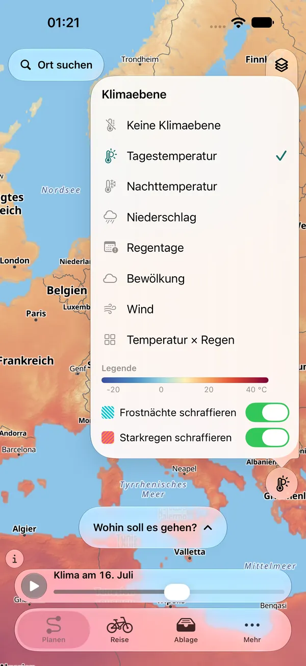
Map of Europe with the day temperature climate layer and the open layer menu: day temperature, night temperature, precipitation, rain days, cloud cover, wind and temperature × rain (app shown in German)

When to ride

Climate and the best departure window

  • Climate map on a globe with a timeline, shown on demand: temperature × rain, day and night temperature, precipitation, rain days, cloud cover and wind for every day of the year
  • Every travel day is rated against your own limits for riding, for camping at night and for heat
  • Best departure window: Pedalglobe works out how many pleasant days each departure week would give you

Climate values are long-term averages for 1995–2024 (cloud cover and wind 1981–2010), not a weather forecast.

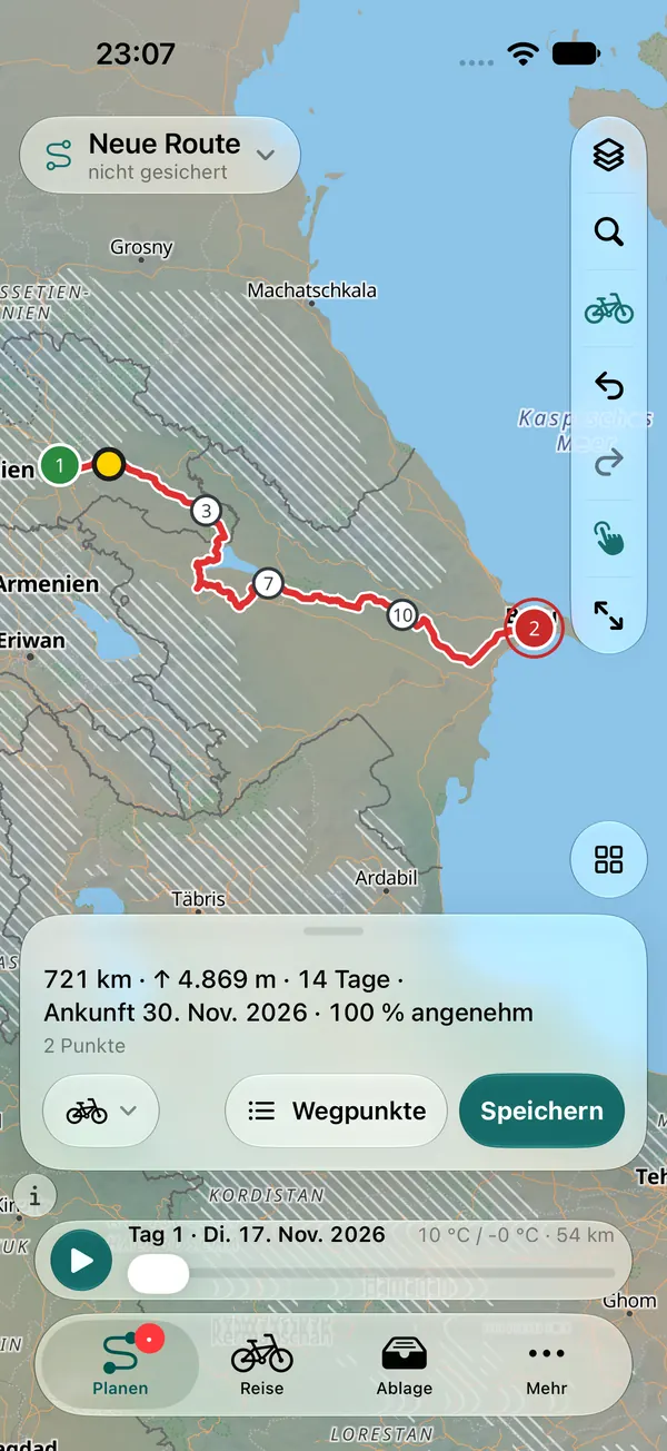
Planned bike route from Tbilisi to Baku: 721 km, 4,869 m of climbing, 14 days, arrival 30 November 2026, 100 % pleasant days (app shown in German)

Where to ride

Worldwide bike routing on your device

  • Pedalglobe follows cycle paths and long-distance cycle routes to suit your bike: loaded touring, gravel, road, bikepacking or e-bike
  • Climbing and an elevation profile for every route
  • The sections needed download after you confirm their size. Then routing also works offline.
  • Search places, regions, mountain ranges and rivers (even offline), add, move and reorder points
  • Pace and rest days: Pedalglobe splits your trip into daily stages and shows where you will be when
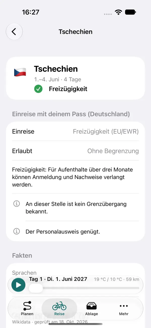
Country page for Czechia: entry with a German passport, free movement, no limit on the stay, a note that the ID card is enough (app shown in German)

Countries and visas

What applies at the next border?

  • For every country along the route: languages, currency, emergency numbers, plugs, time zone and links to official sources, for more than 200 countries and areas
  • Entry rules and permitted length of stay for EU, Swiss, Norwegian and UK passports, for 48 destinations from Europe to Southeast Asia
  • Country timeline and visa schedule: planned vs. permitted days, deadlines as a calendar file, border crossings

Every item shows its source and date. No guarantee – only the authorities of the destination country are binding.

Globe and 3D

Fly over your route

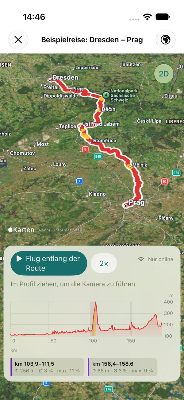
Plan on a globe or a flat map. In the 3D view with Apple Maps you fly along your route and share the flight as a video.

  • 3D flight free up to 1,500 km and on the example trip, with Pro over any route
  • Flight video free for up to 60 seconds in 720p with a small watermark, with Pro in full length up to 1080p without a watermark
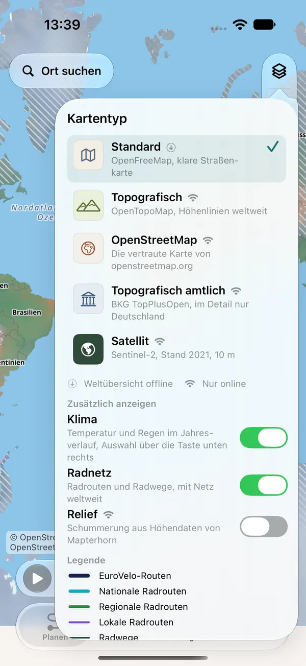
Map type menu: standard, topographic, OpenStreetMap, official topographic and satellite, with switches for climate, cycle network and relief and a legend of cycle routes (app shown in German)

Maps

Map types and cycle network

  • Map types standard, topographic, OpenStreetMap, official topographic and satellite
  • Cycle network and relief overlays: cycle routes and paths worldwide when online, offline in downloaded sections
  • A world overview map is built into the app and works offline
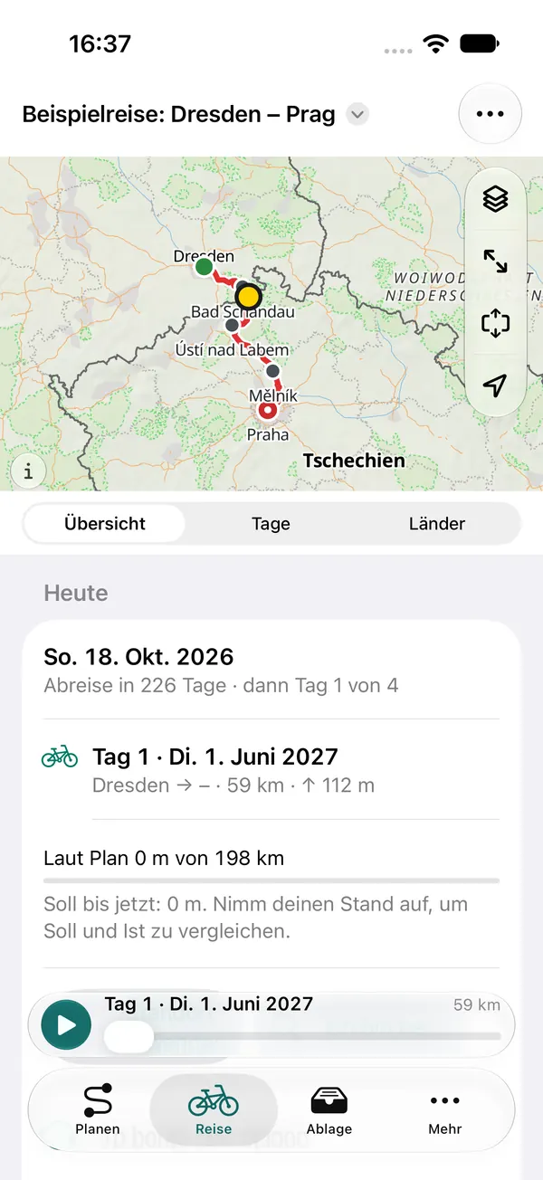
Travel mode Today for an example trip from Dresden to Prague: departure in 226 days, day 1 with 59 km, plan vs. actual (app shown in German)

Trips and on the road

One trip, many routes

  • Combine routes into a trip and link them by train, bus, ferry or flight
  • Travel mode “Today”: the stage of the day, plan vs. actual, visa countdown, “replan from today”
  • Export: GPX for the whole trip or per day, and a roadbook as PDF

iPhone, iPad and iCloud

On all your devices

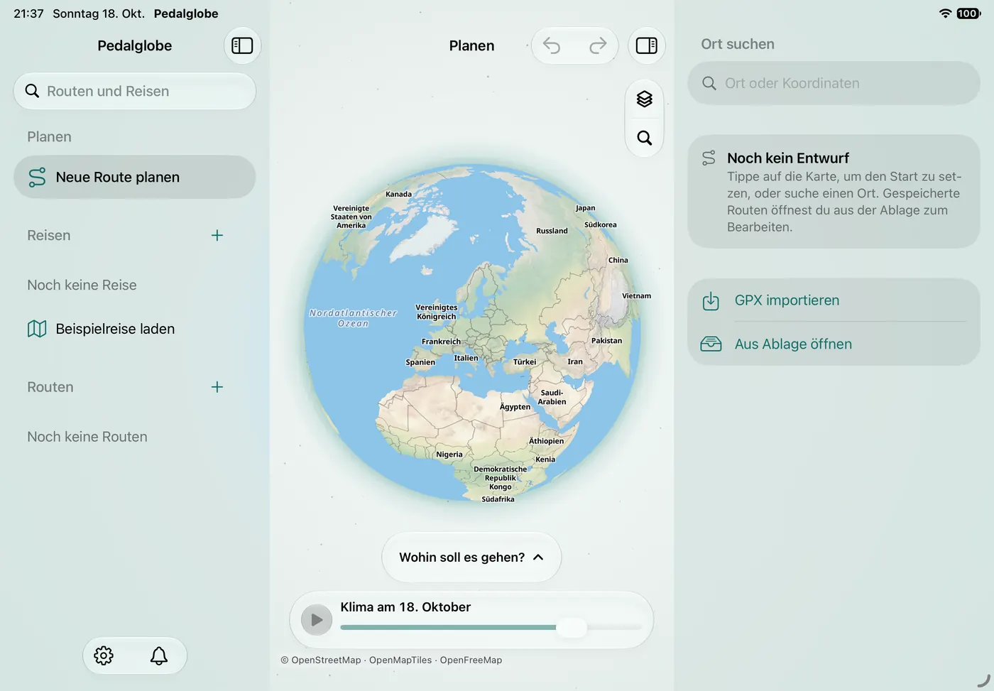
  • Compact on iPhone, with sidebar and inspector on iPad
  • Sync between your devices through your private iCloud (can be turned off). Without iCloud you back up everything to a file.
  • Import and export GPX
  • Guided tour and help in the app
Pedalglobe on iPad in landscape: sidebar with plan, trips and routes on the left, the globe in the middle, the inspector with place search on the right (app shown in German)

Free and Pro

Free: every feature with one trip and unlimited routes up to 1,500 km. Pedalglobe Pro is a one-time In-App Purchase, not a subscription.

Free

€0

No account, no ads

  • Every feature: climate, bike routing, countries, map types, “Today”, iCloud
  • One trip (the example trip Dresden – Tbilisi does not count)
  • Unlimited routes up to 1,500 km
  • All visa and entry information, always free
  • GPX for the whole route or trip
  • 3D flight up to 1,500 km and on the example trip
  • Flight video of up to 60 seconds in 720p with a small watermark

Pedalglobe Pro

€24.99

One-time purchase, no subscription, Family Sharing

  • Everything in the free version
  • As many trips as you like
  • Routes of any length, also over 1,500 km
  • Roadbook as a PDF
  • GPX per day stage
  • 3D flight over any route
  • Flight video in full length up to 1080p without a watermark

Routes and trips you already have are never locked, also when they are longer. The price applies in Germany. In other countries, the price shown in the App Store applies.

Frequently asked questions

Does Pedalglobe work offline?

Largely, yes. Without a connection you can use climate, place search, country information, routes and trips, a world overview map, and routing and the cycle network of downloaded sections.

Map details, satellite, relief and the 3D view load over the internet. Pedalglobe does not offer detailed maps for download.

What happens to my data?

No account, no ads, no tracking, no analytics. Routes and trips stay on your device and, if you use sync, in your private iCloud. Pedalglobe uses your location only if you allow it, and only while you use the app.

The details are in the app privacy policy.

Which devices does Pedalglobe run on? Is there a Mac version?

Pedalglobe runs on iPhone and iPad with iOS or iPadOS 26.1 or later. It is currently not available for the Mac.

Does Pedalglobe give turn-by-turn directions?

Not yet. Live navigation is planned for a later version. On the road, the travel mode “Today” shows the stage of the day, and you can take your routes to other apps and devices as GPX.

Is this a weather forecast?

No. Pedalglobe shows long-term climate averages for 1995–2024 (cloud cover and wind 1981–2010). They tell you what to expect typically and help you choose when to travel. The weather on the day may differ.

Which passports do the entry rules cover?

Entry rules and the permitted length of stay cover EU, Swiss, Norwegian and UK passports for 48 destinations from Europe to Southeast Asia. Country facts and links to official sources are shown for every passport and for more than 200 countries and areas.

Is Pedalglobe Pro a subscription?

No. Pro is a one-time In-App Purchase through your Apple Account. It applies on all your devices and, with Family Sharing, to your family group. After reinstalling, tap Restore Purchases under More.

Where do maps, climate and country data come from?

Map and cycle network are based on OpenStreetMap (© OpenStreetMap contributors, ODbL), the map comes via OpenFreeMap. Satellite imagery is made from Copernicus Sentinel-2 data, relief comes from Mapterhorn, climate from CHELSA and CRU TS, places from GeoNames, country facts from Wikidata and Natural Earth, elevation from the Copernicus DEM. All sources and licences are listed under Data sources & licences.

More questions? Answers about iCloud, routing and purchases are under Help & support.